GeoCalib
GeoCalib from ETH Zurich (CVG): camera-calibration and gravity-estimation; Verified.
GeoCalib estimates camera calibration and the gravity direction from a single image by combining geometric optimization with deep learning. In this catalog it is a verified camera-calibration prior consumed by higher-level pipelines (notably VIPE) through the shared geometry-prior contract.
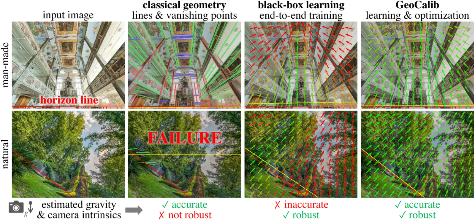
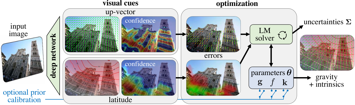
The recorded paper is arXiv 2409.06704.
Project page: cvg.ethz.ch/research/geocalib. Code: cvg/GeoCalib.
Paper: arXiv 2409.06704. Project: cvg.ethz.ch/research/geocalib. Code: cvg/GeoCalib (Apache-2.0). Official release tarball: geocalib-pinhole.tar from the v1.0 GitHub release. Publisher: ETH Zurich (CVG). Aliases: geocalib, cvg-geocalib. Runner: verified. Per-run evidence stays outside the catalog.
Build your run
GeoCalibPriorPipelineworldfoundry.pipelines.geometry_priors.pipeline_geometry_priorsdefaultworldfoundry.pipelineworldfoundry-eval run \
geocalib-prior \
--pipeline.task-profile default \
--jsonWhat it is for
geocalib-prior is the recorded reconstruction line. Start here to emit geometry from the documented views.
A neural network predicts geometric cues which a differentiable optimization layer turns into focal length and gravity estimates (per the upstream ECCV 2024 release). Registered at base_models/three_dimensions/general_3d/geocalib; apache-2.0. It is published by ETH Zurich (CVG).
Catalog tasks include camera-calibration, gravity-estimation, and geometry-prior. Catalog aliases include geocalib and cvg-geocalib.
Runtime contract
Optional input_path, camera_model, execute, max_points, and focal_length; artifacts geocalib-prior.json.
CLI task profiles: default. WorldFoundry binds GeoCalibPriorPipeline.
Family status: Verified.
It is integrated as an independent geometry prior under worldfoundry/base_models and exposed through the shared geometry-prior pipeline/operator contract. Higher-level pipelines (e.g. ViPE) import it from this canonical owner instead of keeping private copies. Runner parity is verified through the shared contract.
Integrated as an independent camera-calibration prior at worldfoundry/base_models/three_dimensions/general_3d/geocalib.
Running in WorldFoundry
The catalog launch is worldfoundry-eval run geocalib-prior --pipeline.task-profile default. The command builder above switches --pipeline.task-profile among recorded tasks and still emits worldfoundry-eval run.
It runs in the unified environment worldfoundry-unified-cu128 (Python 3.11, CUDA 12.8).
No public checkpoint id is recorded on this card; follow the usage notes for staging. Prepare the environment and check local assets with bash scripts/inference/prepare_model_infer.sh geocalib-prior. Add --download to fetch missing public checkpoints.
Status: Verified.